|
Goodhand Creek Kayak Fishing Trip
October
4th, 2013
The Dance with The Tides.....
First
trip to the "Narrows"... and after much research... the
tide would be an important factor to the route and the day's fishing
and paddle.
At the Kent Narrow's Bridge.. it is a narrow passage
between the Chester River to the north, and Prospect Bay to the
south. And as such... a strong current passes through
the "Narrows" with the tide. Many stories
are told battling the current under the Narrows Bridge... fighting
position fishing, landing fish drifting quickly between the spans...
trying to recover snagged gear while maintaing direction... all
the time dodging boats.
And of course shore fisherman
that take pleasure at making you a bombing target with three once
weights. I was lucky... only a few boats.. no
shore fisherman.. there was a modest current.
The Narrows area is an interesting area... especially if you
are only accoustom to current in a wide body of water. There
are many variances of shoreline, and quick fluctuations of depths.
And it is fun ! If not challenging. Leaving
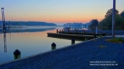
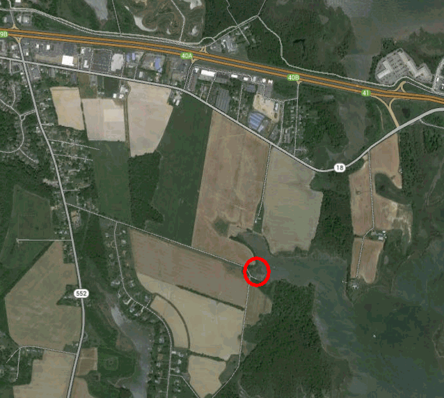
the launch at Goodhands Creek...  it
is a very mellow soothing paddle. One makes his way
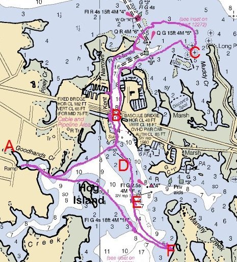
out of the calm tributary and enters the area either north of Hog
Island or south. Heading north I made my way close
to shore... and then headed towards the "Narrows" between
the breakwater and shore... and into the main body of the Narrows. it
is a very mellow soothing paddle. One makes his way
out of the calm tributary and enters the area either north of Hog
Island or south. Heading north I made my way close
to shore... and then headed towards the "Narrows" between
the breakwater and shore... and into the main body of the Narrows.
At point X between the breakwater and the shoreline the water goes deep. There
are upwellings and eddies... you can hunker down behind the breakwater
to maintain position or anchor if you choose to fish this area.
I tossed out some lures without much enthusiasm... a
boat was working the area and I didn't feel to give the area competition.
I headed for crossing under the Kent Narrows Bridge. And
as it was a day with a modest current, I was paddling against the
current (tide going out)... it was still quite a challenge. Making
one mile per hour with good effort. Mind you... I'm in a bit
of tug boat as the Pescadora is only ten feet long.
There are many eddies and currents as you make your way out past
the Narrows along the points of land. And many fishing oportunities
along the wayand into the Chester River. Two things
I wanted to try... One was that although the Spot were decreasing
in the shallows, fishing reports had them hunkering down in deeper
water. I wanted to make it out north of the Narrows
and into deeper water to try and get some spot. Two was to
try and work the wrecks at Point C on the map. You often
see boats working Point C when you cross the Kent Narrows Bridge.
I got to
Point C...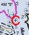 and fished for a while... no fish were showing on the sonar (fish
finder) and I didn't have any success. I had concerns
about fighing the current back through the Narrows as the tide turn
was in an hour and half.... so making deeper waters north was out
of the pland. I drifted back north in the Chester River...
fishing, eating a snack... and having a cigar. Enjoying the
day and taking some pictures.
I worked my way back into the
Narrows... and worked the Narrows and boat docks. I
caught a handful of Perch in the docks.... and caught four Blues
in the ten to twelve inch size. I kept the Blues putting
them in the ice chest. A boat was working the Narrows
under the bridge but without much success as I passed through to
the south with the out going tide. As this was an exploratory
trip, first trip, to the area, I went with the tide and saw off
in the distance a small beach that I'd make for lunch. I
caught two Rockfish along the way near Point E... there were in
the ten inch size... happy to have caught some Stripers trolling
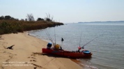
on the beautiful day I made the beach and had lunch at Pont F. By
now the tide had turned and I paddled my way back.
Caught some
fish... a great day....
|
 it
is a very mellow soothing paddle. One makes his way
out of the calm tributary and enters the area either north of Hog
Island or south. Heading north I made my way close
to shore... and then headed towards the "Narrows" between
the breakwater and shore... and into the main body of the Narrows.
 between the breakwater and the shoreline the water goes deep. There
are upwellings and eddies... you can hunker down behind the breakwater
to maintain position or anchor if you choose to fish this area.
I tossed out some lures without much enthusiasm... a
boat was working the area and I didn't feel to give the area competition.
 and fished for a while... no fish were showing on the sonar (fish
finder) and I didn't have any success. I had concerns
about fighing the current back through the Narrows as the tide turn
was in an hour and half.... so making deeper waters north was out
of the pland. I drifted back north in the Chester River...
fishing, eating a snack... and having a cigar. Enjoying the
day and taking some pictures.